 Geographic Information Science
Program Description
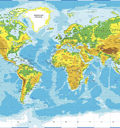
The BS degree in Geographic Information Science (GIS) is a new degree in one of the fastest growing STEM areas of science and information technology. This degree provides the foundation for a career in the emerging field that integrates computer science, information technology with geographic concepts and techniques to support management and resilience of earth's natural environmental, urban and human systems. GIS uses massive data sets from satellite imagery, drones, digital mapping, GPS, geospatial statistics to create knowledge to analyze and solve 21st Century problems.
Geography has long used maps and images as models of the earth surface and physical/human processes. The advent of digital cartography, satellite imagery, global positioning systems and geographically-informed digital databases (Google Earth, vehicle navigation systems, etc) has transformed the use of traditional geographic theory, methodology and techniques to 21st Century science and technology to address issues confronting the earth and human societies. The Department of Labor estimates that employment for Geographic Information Scientists will increase 29% across the United States and 105% in Utah by the year 2022.
Geographic Information Science is a federally recognized STEM discipline allied with the Cartography and Geospatial Intelligence designations. The Geography Department is designated by the National Geospatial Intelligence Agency (NGA), the US Geological Survey (USGS ) as a National Center of Academic Excellence in Geospatial Sciences, and the Environmental Systems Research Institute (ESRI) as a development center.
The Student Experience
For academic enrichment and the chance to network, students can complete an undergraduate research project or internship: both options allow you to pursue an individual area of interest while also gaining valuable hands-on and professional skills. Additional involvement opportunities include the Geography Club.
Academic and Career Opportunities
For academic enrichment, consider completing a research project or internship. After graduation, students can pursue careers in cartography, hydrology, and surveying. You may also combine your GIS skills with other abilities and specialize in GIS-related fields: become a GIS software developer or data manager, a GIS systems analyst or administrator, or continue your studies at the graduate level to teach GIS or conduct research in the field.
Additional Career Opportunities Include:
- Department of Defense
- US Department of Transportation
- Urban Planning
- United States Geological Survey (USGS)
- Natural Resource Management (Forest Service, Fish and Game) Environmental consulting and Conservation Non-Profits Non-Governmental Organizations (NGO's)
- Spatial Software/Environmental Systems Research Institute (ESRI)
More Info
- School of Environment, Society & Sustainability
- College of Social & Behavioral Science
- Department Advising
- U Career Success
Catalog
Exploratory Classes
Related Programs
Geography
Geography is the study of natural Earth systems, human societies and the interaction between them. Geography bridges the physical and social sciences.
about GeographyLearn More about Geography
Computer Science
The undergraduate program begins with a set of two courses that give students a solid background in object-oriented programming while exposing them to the breadth of issues that arise in computer science.
about Computer ScienceLearn More about Computer Science
Information Systems
As a student in this program, you will learn the tools to manage the technical direction of business, solve technological issues, and implement new technological advances to enrich business operations.
about Information SystemsLearn More about Information SystemsWhat if I studied...

Kinesiology
The Kinesiology degree program prepares students for careers in human movement, exercise science, and health promotion.
about KinesiologyLearn More about Kinesiology